
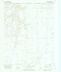
1973 Map of Waka
USGS Topo · Published 1976About this map
The settlement of Waka sits at the junction of rail and road in the Texas Panhandle, positioned along the Atchison Topeka and Santa Fe railroad line. This 1973 survey reveals a landscape heavily shaped by energy production, dominated by an extensive Gas Field and a dense network of Pipelines and Pipeline corridors. The presence of a Pumping Sta and numerous sites marked Oil Well and Gas Well underscore the industrial character of the region during the early 1970s.
Find a feature on this map
12 named features on this map. Tap any name to fly to it.
Don’t see what you’re looking for? This feature index may not catch every label — zoom into the map to look around manually.
Map Details
Editions of this 1973 Waka Map
This is the sole edition of this map. No revisions or reprints were ever made.
Other maps of this area

1954 · Perryton
USGS Topo · 1:250,000

1958 · Perryton
USGS Topo · 1:250,000

1962 · Hansford Camp
USGS Topo · 1:24,000

1962 · Waka SW
USGS Topo · 1:24,000

1962 · Spearman
USGS Topo · 1:24,000

1973 · Farnsworth
USGS Topo · 1:24,000

1973 · Horseshoe Hill
USGS Topo · 1:24,000

1973 · Spearman NE
USGS Topo · 1:24,000

1973 · Sourdough Creek NW
USGS Topo · 1:24,000
1973 · Perryton NW
USGS Topo · 1:24,000