
1973 Map of Booker SW
USGS Topo · Published 1975About this map
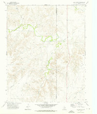
Oil and gas infrastructure dominates the High Plains landscape of Ochiltree County in the early 1970s. The northern reaches of the sheet are characterized by a dense grid of extraction points, including numerous Gas Well and Oil Well sites, alongside a dedicated Pumping Sta and a recorded Drill Hole. The terrain shifts dramatically in the south, where the level agricultural and industrial plateau gives way to the complex, eroded drainages of Cottonwood Arroyo. Here, the land is etched with deep draws and ridges, creating a stark contrast to the surveyed regularity of the upland petroleum fields. The tiny settlement footprint of Holdman sits near the center of this activity, while a Gravel Pit in the southwest suggests local material extraction supporting the region's heavy transport and industrial needs.
Find a feature on this map
9 named features on this map. Tap any name to fly to it.
Don’t see what you’re looking for? This feature index may not catch every label — zoom into the map to look around manually.
Map Details
Editions of this 1973 Booker SW Map
This is the sole edition of this map. No revisions or reprints were ever made.
Other maps of this area

1954 · Perryton
USGS Topo · 1:250,000

1958 · Perryton
USGS Topo · 1:250,000

1972 · Booker SE
USGS Topo · 1:24,000

1973 · Booker
USGS Topo · 1:24,000

1973 · Sourdough Creek NE
USGS Topo · 1:24,000

1973 · Perryton SE
USGS Topo · 1:24,000

1973 · Perryton
USGS Topo · 1:24,000

1973 · Lake Fryer
USGS Topo · 1:24,000
1973 · Lake Fryer NE
USGS Topo · 1:24,000

1973 · Huntoon
USGS Topo · 1:24,000