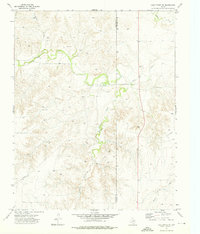
1973 Map of Lake Fryer NE
USGS Topo · Published 1976About this map
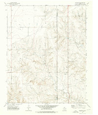
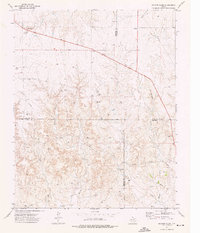
The high plains of the Texas Panhandle are defined here by the winding course of Wolf Creek, which carves a distinct valley through the northern Ochiltree County landscape. Surveyed in the early 1970s, this area shows a transition from open cattle range to an active energy extraction zone. Numerous Gas Well and Oil Well sites are scattered across the high ground between drainage systems like Gibson Creek and Cottonwood Arroyo. A prominent Pipeline corridor cuts across the terrain, illustrating the infrastructure required to move resources from these isolated wells to wider markets. The county boundary between Ochiltree Co and Lipscomb Co runs vertically through the eastern portion of the map, marked by a long, straight road that serves as a primary transit line through this sparsely populated ranching and mineral district.
Find a feature on this map
12 named features on this map. Tap any name to fly to it.
Don’t see what you’re looking for? This feature index may not catch every label — zoom into the map to look around manually.
Map Details
Editions of this 1973 Lake Fryer NE Map
This is the sole edition of this map. No revisions or reprints were ever made.
Other maps of this area

1954 · Perryton
USGS Topo · 1:250,000

1958 · Perryton
USGS Topo · 1:250,000
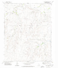
1972 · Barton Corners
USGS Topo · 1:24,000
1972 · Lipscomb SW
USGS Topo · 1:24,000
1972 · Twin Grove
USGS Topo · 1:24,000
1972 · Booker SE
USGS Topo · 1:24,000
1973 · Booker SW
USGS Topo · 1:24,000
1973 · Pickett Ranch Creek
USGS Topo · 1:24,000
1973 · Lake Fryer
USGS Topo · 1:24,000
1973 · Barton Creek
USGS Topo · 1:24,000