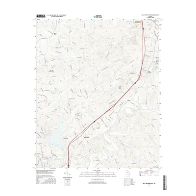
2017 Map of Ball Ground West
USGS Topo · Published 2017About this map
The Etowah River carves through this northern Georgia landscape, serving as a geographic anchor for the communities of Canton, Ball Ground, and Keithsburg. The area is characterized by a network of winding roads and significant water bodies like Canton Mills Lake and Sharp Mountain Creek, illustrating the region's connection to its riverine environment. For genealogists, the map is a vital resource, identifying numerous burial sites including the Ball Ground City Cem, McFarland Cem, and Keith Cem, which reflect the long-standing family settlements of Cherokee County. The presence of the Cherokee County Airport and the corridor near Nelson indicate the area's development as it bridges the boundary between Pickens and Cherokee counties. Smaller crossroads like Burris Crossroads and Gober represent the more localized rural patterns that have persisted alongside larger infrastructure.
Find a feature on this map
151 named features on this map. Tap any name to fly to it.
Don’t see what you’re looking for? This feature index may not catch every label — zoom into the map to look around manually.
Map Details
Editions of this 2017 Ball Ground West Map
This is the sole edition of this map. No revisions or reprints were ever made.
Other maps of this area

1890 · Suwanee
USGS Topo · 1:125,000

1890 · Cartersville
USGS Topo · 1:125,000

1891 · Cartersville
USGS Topo · 1:125,000

1894 · Suwanee
USGS Topo · 1:125,000

1896 · Cartersville
USGS Topo · 1:125,000

1907 · Acworth
USGS Topo · 1:62,500

1909 · Acworth
USGS Topo · 1:62,500

1926 · Tate
USGS Topo · 1:62,500

1928 · Tate
USGS Topo · 1:62,500

1947 · Waleska
USGS Topo · 1:62,500