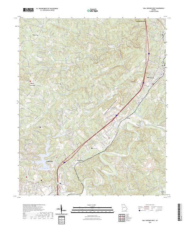
2024 Map of Ball Ground West
USGS Topo · Published 2024About this map
The Etowah River carves through the southern reaches of this landscape, anchoring a region defined by the historic Piedmont settlements of Canton and Ball Ground. This modern topographic study reveals a complex network of rural and developing areas, where established communities like Keithsburg and Gober sit alongside contemporary infrastructure like the Cherokee County Airport. The terrain is marked by significant ridges, including Srargage Ridge and Sunshower Ridge, which overlook numerous small reservoirs such as Canton Mills Lake and Payne-Smith Lake. For genealogists and local historians, the map is particularly rich in burial sites, documenting several community landmarks including Hopewell Cem, McFarland Cem, and the Ball Ground Baptist Cem. The drainage patterns of Sharp Mountain Creek and Bluff Creek illustrate the winding topography that has shaped movement and settlement in Cherokee County for generations.
Find a feature on this map
170 named features on this map. Tap any name to fly to it.
Don’t see what you’re looking for? This feature index may not catch every label — zoom into the map to look around manually.
Map Details
Editions of this 2024 Ball Ground West Map
This is the sole edition of this map. No revisions or reprints were ever made.
Other maps of this area

1890 · Suwanee
USGS Topo · 1:125,000

1890 · Cartersville
USGS Topo · 1:125,000

1891 · Cartersville
USGS Topo · 1:125,000

1894 · Suwanee
USGS Topo · 1:125,000

1896 · Cartersville
USGS Topo · 1:125,000

1907 · Acworth
USGS Topo · 1:62,500

1909 · Acworth
USGS Topo · 1:62,500

1926 · Tate
USGS Topo · 1:62,500

1928 · Tate
USGS Topo · 1:62,500

1947 · Waleska
USGS Topo · 1:62,500