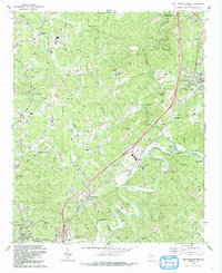
1992 Map of Ball Ground West
USGS Topo · Published 1993About this map
The Etowah River carves a winding path through the southern half of this landscape, anchoring a region defined by established rural crossroads and early aviation infrastructure. Near the northern bend of the river, Keithsburg and the Cherokee County Airport represent the shifting economic landscape of the late twentieth century, while the community of Ball Ground occupies the northeast corner. This area serves as a significant cultural corridor, evidenced by numerous historical faith sites such as Old Damascus Ch, Shoal Creek Ch, and Sharp Mtn Ch.
Find a feature on this map
50 named features on this map. Tap any name to fly to it.
Don’t see what you’re looking for? This feature index may not catch every label — zoom into the map to look around manually.
Map Details
Editions of this 1992 Ball Ground West Map
This is the sole edition of this map. No revisions or reprints were ever made.
Other maps of this area

1890 · Suwanee
USGS Topo · 1:125,000

1890 · Cartersville
USGS Topo · 1:125,000

1891 · Cartersville
USGS Topo · 1:125,000

1894 · Suwanee
USGS Topo · 1:125,000

1896 · Cartersville
USGS Topo · 1:125,000

1907 · Acworth
USGS Topo · 1:62,500

1909 · Acworth
USGS Topo · 1:62,500

1926 · Tate
USGS Topo · 1:62,500

1928 · Tate
USGS Topo · 1:62,500

1947 · Waleska
USGS Topo · 1:62,500