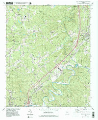
1997 Map of Ball Ground West
USGS Topo · Published 1999About this map
The Etowah River snakes across the southern portion of this landscape, its deep meanders framing the industrial and residential growth of late-twentieth-century Cherokee County. The L & N RR corridor serves as a primary transit spine, connecting the northern settlement of Ball Ground to the outskirts of Canton in the south. This era reflects a transition between traditional rural life and expanding infrastructure, evidenced by the concentration of faith-based community centers like Old Damascus Ch, Pilgrim Ch, and Welcome Valley Ch.
Find a feature on this map
65 named features on this map. Tap any name to fly to it.
Don’t see what you’re looking for? This feature index may not catch every label — zoom into the map to look around manually.
Map Details
Editions of this 1997 Ball Ground West Map
This is the sole edition of this map. No revisions or reprints were ever made.
Other maps of this area

1890 · Suwanee
USGS Topo · 1:125,000

1890 · Cartersville
USGS Topo · 1:125,000

1891 · Cartersville
USGS Topo · 1:125,000

1894 · Suwanee
USGS Topo · 1:125,000

1896 · Cartersville
USGS Topo · 1:125,000

1907 · Acworth
USGS Topo · 1:62,500

1909 · Acworth
USGS Topo · 1:62,500

1926 · Tate
USGS Topo · 1:62,500

1928 · Tate
USGS Topo · 1:62,500

1947 · Waleska
USGS Topo · 1:62,500