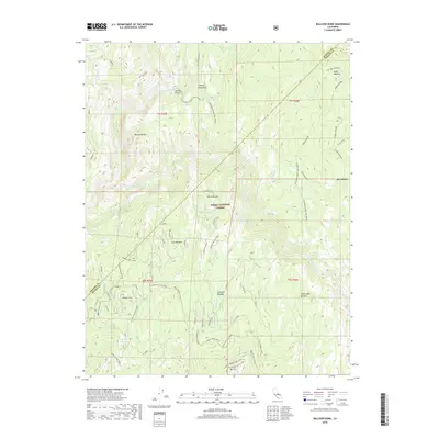
2018 Map of Balloon Dome
USGS Topo · Published 2018About this map
Balloon Dome rises above the dramatic confluence of the San Joaquin River and its South Fork, defining a landscape of deep canyons and high mountain meadows within the Sierra National Forest. This 2018 survey documents the intricate network of pack trails and forest routes, including the California Riding and Hiking trail and the Kaiser Loop Half Corral, that connect remote points like Paradise Lost and Hoffman Meadow. The terrain is punctuated by significant peaks such as Mt Tom, which features the Mt Tom Lookout Mount Tom.
Find a feature on this map
35 named features on this map. Tap any name to fly to it.
Don’t see what you’re looking for? This feature index may not catch every label — zoom into the map to look around manually.
Map Details
Editions of this 2018 Balloon Dome Map
This is the sole edition of this map. No revisions or reprints were ever made.
Other maps of this area

1901 · Mt. Lyell
USGS Topo · 1:125,000

1904 · Kaiser
USGS Topo · 1:125,000

1947 · Mariposa
USGS Topo · 1:250,000

1948 · Mariposa
USGS Topo · 1:250,000

1953 · Merced Peak
USGS Topo · 1:62,500

1953 · Devils Postpile
USGS Topo · 1:62,500

1953 · Shuteye Peak
USGS Topo · 1:62,500

1953 · Kaiser Peak
USGS Topo · 1:62,500

1957 · Mariposa
USGS Topo · 1:250,000

1963 · Mariposa
USGS Topo · 1:250,000