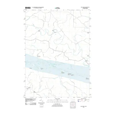
2010 Map of Balltown
USGS Topo · Published 2010About this map
The Mississippi River dominates this tri-state borderland, where the Iowa and Wisconsin shorelines are separated by a complex network of side channels and islands. On the Iowa side, the settlement of Balltown and its precursor Old Balltown sit atop the high bluffs overlooking the river valley, near the Saint Francis Assisi Cemetery. The landscape is deeply dissected by drainages like West Basswood Creek and Haberkorn Creek, which carve steep routes toward the river plain. Across the water, the Wisconsin riverfront features small landings and points of interest such as McCartney and Cameron. The river itself is filled with named features of the Upper Mississippi, including Hurricane Island, Snyder Slough, and Rosebrook Island. This survey illustrates the intricate relationship between the elevated agricultural uplands and the swampy, island-choked riparian corridor, connected by crossings like the Burton Bridge and Masseyville Bridge.
Find a feature on this map
54 named features on this map. Tap any name to fly to it.
Don’t see what you’re looking for? This feature index may not catch every label — zoom into the map to look around manually.
Map Details
Editions of this 2010 Balltown Map
This is the sole edition of this map. No revisions or reprints were ever made.
Other maps of this area

1900 · Lancaster
USGS Topo · 1:125,000

1904 · Lancaster
USGS Topo · 1:125,000

1908 · Lancaster
USGS Topo · 1:125,000

1955 · Cassville
USGS Topo · 1:24,000

1955 · Balltown
USGS Topo · 1:24,000

1956 · Dubuque North
USGS Topo · 1:24,000

1956 · Sherrill
USGS Topo · 1:24,000

1957 · Holy Cross
USGS Topo · 1:24,000

1957 · Potosi
USGS Topo · 1:24,000

1959 · Dubuque
USGS Topo · 1:250,000