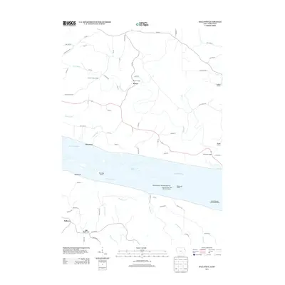
2013 Map of Balltown
USGS Topo · Published 2013About this map
The Mississippi River serves as the central artery for this borderland geography, where the river's complex braided channels and islands create a distinct riparian landscape between Iowa and Wisconsin. Navigation and local history are reflected in features such as Snyder Slough and the numbered islands including Island Number Two Hundred Five and Island Number Two Hundred Seven. On the Iowa side, the settlement of Balltown and the nearby Old Balltown highlight the shifting centers of local life over time, set against a backdrop of tributary creeks like Haberkorn Cr and W Basswood Cr. To the north across the river, the Wisconsin shoreline is defined by the Grant River and small riverfront communities like McCartney and Burton. The map documents numerous hollows such as Graham Hollow and Rigsby Hollow, alongside riverfront landmarks like Hurricane Island and Rosebrook Island, illustrating the enduring influence of the river's path on regional development.
Find a feature on this map
67 named features on this map. Tap any name to fly to it.
Don’t see what you’re looking for? This feature index may not catch every label — zoom into the map to look around manually.
Map Details
Editions of this 2013 Balltown Map
This is the sole edition of this map. No revisions or reprints were ever made.
Other maps of this area

1900 · Lancaster
USGS Topo · 1:125,000

1904 · Lancaster
USGS Topo · 1:125,000

1908 · Lancaster
USGS Topo · 1:125,000

1955 · Cassville
USGS Topo · 1:24,000

1955 · Balltown
USGS Topo · 1:24,000

1956 · Dubuque North
USGS Topo · 1:24,000

1956 · Sherrill
USGS Topo · 1:24,000

1957 · Holy Cross
USGS Topo · 1:24,000

1957 · Potosi
USGS Topo · 1:24,000

1959 · Dubuque
USGS Topo · 1:250,000