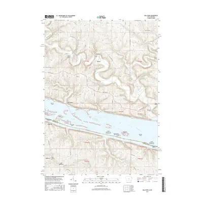
2015 Map of Balltown
USGS Topo · Published 2015About this map
The Mississippi River defines the border between Grant County, Wisconsin, and Dubuque County, Iowa, creating a complex corridor of waterways and islands. This landscape is marked by the winding courses of the Grant River and McCartney Branch, which feed into the main channel near McCartney. Significant island formations like Hurricane Island, Rosebrook Island, and Mulligan Island are separated from the shore by Hurricane Chute and Snyder Slough, illustrating the dynamic nature of the river's path.
Find a feature on this map
76 named features on this map. Tap any name to fly to it.
Don’t see what you’re looking for? This feature index may not catch every label — zoom into the map to look around manually.
Map Details
Editions of this 2015 Balltown Map
This is the sole edition of this map. No revisions or reprints were ever made.
Other maps of this area

1900 · Lancaster
USGS Topo · 1:125,000

1904 · Lancaster
USGS Topo · 1:125,000

1908 · Lancaster
USGS Topo · 1:125,000

1955 · Cassville
USGS Topo · 1:24,000

1955 · Balltown
USGS Topo · 1:24,000

1956 · Dubuque North
USGS Topo · 1:24,000

1956 · Sherrill
USGS Topo · 1:24,000

1957 · Holy Cross
USGS Topo · 1:24,000

1957 · Potosi
USGS Topo · 1:24,000

1959 · Dubuque
USGS Topo · 1:250,000