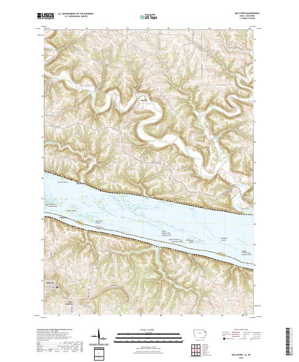
2022 Map of Balltown
USGS Topo · Published 2022About this map
The Mississippi River creates a broad, braided boundary between Iowa and Wisconsin, defining the character of this riverine landscape. On the Iowa side, the community of Balltown and its predecessor, Old Balltown, sit atop the high ridges overlooking the valley, with the Saint Francis of Assisi Cem serving as a local landmark. The terrain is deeply incised by drainages like Basswood Cr and Haberkorn Cr, which flow toward the river's expansive floodplain.
Find a feature on this map
74 named features on this map. Tap any name to fly to it.
Don’t see what you’re looking for? This feature index may not catch every label — zoom into the map to look around manually.
Map Details
Editions of this 2022 Balltown Map
This is the sole edition of this map. No revisions or reprints were ever made.
Other maps of this area

1900 · Lancaster
USGS Topo · 1:125,000

1904 · Lancaster
USGS Topo · 1:125,000

1908 · Lancaster
USGS Topo · 1:125,000

1955 · Cassville
USGS Topo · 1:24,000

1955 · Balltown
USGS Topo · 1:24,000

1956 · Dubuque North
USGS Topo · 1:24,000

1956 · Sherrill
USGS Topo · 1:24,000

1957 · Holy Cross
USGS Topo · 1:24,000

1957 · Potosi
USGS Topo · 1:24,000

1959 · Dubuque
USGS Topo · 1:250,000