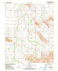
1991 Map of Bally Mountain
USGS Topo · Published 1992About this map
Bally Mountain and the surrounding peaks of the Wichita Mountains dominate this southwestern Oklahoma landscape, where the terrain breaks sharply into high ridges and narrow creek valleys. Surveyed in the late 1980s, the map reveals a sparsely populated ranching district defined by its topography rather than urban centers. The Ferrel Ranch Landing Strip and a prominent Radio Tower atop Zodletone Mountain represent the modern infrastructure of the era, while the Green Valley Cem near Pecan Creek offers a tangible connection to the area's rural heritage. Waterways like Saddle Mountain Creek and various unnamed springs provide the primary drainage for the rugged elevations of Longhorn Mountain and Saddle Mountain, which separate the flatlands of the southern plains from the stony heights of the quadrangle.
Find a feature on this map
11 named features on this map. Tap any name to fly to it.
Don’t see what you’re looking for? This feature index may not catch every label — zoom into the map to look around manually.
Map Details
Editions of this 1991 Bally Mountain Map
This is the sole edition of this map. No revisions or reprints were ever made.
Other maps of this area

1949 · Cooperton
USGS Topo · 1:62,500

1950 · Saddle Mountain
USGS Topo · 1:62,500

1955 · Lawton
USGS Topo · 1:250,000

1955 · Clinton
USGS Topo · 1:250,000

1956 · Saddle Mountain
USGS Topo · 1:24,000

1956 · Cooperton
USGS Topo · 1:24,000

1956 · Alden
USGS Topo · 1:24,000

1956 · Bally Mountain
USGS Topo · 1:24,000

1956 · Unap Mountain
USGS Topo · 1:24,000

1956 · Meers
USGS Topo · 1:24,000