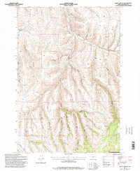
1995 Map of Balm Canyon
USGS Topo · Published 1998About this map
Rhea Creek and its complex network of seasonal tributaries define this high-elevation landscape in the Blue Mountains during the mid-1990s. The map highlights a remote section of the Umatilla National Forest, where the terrain is carved by deeply incised drainages like Waterfall Canyon, Doug Canyon, and Lunceford Canyon. The placement of the Rhea Creek Cem near the junction of Graveyard Canyon serves as a significant genealogical marker for the early ranching and homesteading families who settled along these riparian corridors.
Find a feature on this map
27 named features on this map. Tap any name to fly to it.
Don’t see what you’re looking for? This feature index may not catch every label — zoom into the map to look around manually.
Map Details
Editions of this 1995 Balm Canyon Map
This is the sole edition of this map. No revisions or reprints were ever made.
Other maps of this area

1953 · Pendleton
USGS Topo · 1:250,000

1956 · Pendleton
USGS Topo · 1:250,000

1968 · Ruggs
USGS Topo · 1:24,000

1968 · Heppner
USGS Topo · 1:24,000

1968 · Skinners Fork
USGS Topo · 1:24,000

1969 · Summerfield Ridge
USGS Topo · 1:24,000

1969 · Chapin Creek
USGS Topo · 1:24,000

1969 · Madison Butte
USGS Topo · 1:24,000

1969 · Hardman
USGS Topo · 1:24,000

1969 · Big Rock Flat
USGS Topo · 1:24,000