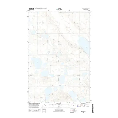
2014 Map of Balta SE
USGS Topo · Published 2014About this map
Battema Lake and Girard Lake dominate the glaciated topography of this Pierce County landscape, situated within the prairie pothole region of North Dakota. The terrain is characterized by numerous small, unnamed depressions and wetlands that punctuate the high-plateau surface. A rigorous section-line road grid, including 49th St NE and 26th Ave NE, organizes the rural space, reflecting the enduring legacy of the Public Land Survey System. The east-west corridor of Nd-19 provides the primary transit artery through the southern portion of the quadrangle, while Cr-3532 connects the scattered farmsteads and agricultural plots that define the local economy. This 2014 survey documents the persistence of the traditional agrarian layout in an area where water and land management are intrinsically linked by the natural drainage patterns of the plains.
Find a feature on this map
18 named features on this map. Tap any name to fly to it.
Don’t see what you’re looking for? This feature index may not catch every label — zoom into the map to look around manually.
Map Details
Editions of this 2014 Balta SE Map
This is the sole edition of this map. No revisions or reprints were ever made.
Other maps of this area

1940 · Aylmer
USGS Topo · 1:62,500

1941 · Selz
USGS Topo · 1:62,500

1951 · Selz NW
USGS Topo · 1:24,000

1952 · New Rockford
USGS Topo · 1:250,000

1953 · Devils Lake
USGS Topo · 1:250,000

1954 · Minot
USGS Topo · 1:250,000

1954 · McClusky
USGS Topo · 1:250,000

1956 · New Rockford
USGS Topo · 1:250,000

1956 · Devils Lake
USGS Topo · 1:250,000

1958 · McClusky
USGS Topo · 1:250,000