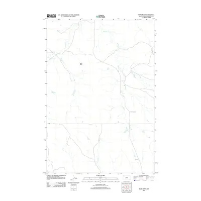
2012 Map of Bams Butte
USGS Topo · Published 2012About this map
Bams Butte rises above the drainage basins of Harding County in this western South Dakota landscape. The terrain is defined by the winding paths of Meathook Cr and Wolf Cr, which move across a region largely dedicated to ranching operations. Significant local landmarks include the Vroman Ranch and the Meat Hook Ranch, reflecting the area's agricultural identity. Near the southern edge of the quadrangle lies Murchison, situated along a network of rural roads such as Limpert Rd and J B Rd. This 2012 survey illustrates a sparsely populated territory where water sources like Double X Cr dictate the placement of ranch infrastructure and livestock trails.
Find a feature on this map
10 named features on this map. Tap any name to fly to it.
Don’t see what you’re looking for? This feature index may not catch every label — zoom into the map to look around manually.
Map Details
Editions of this 2012 Bams Butte Map
This is the sole edition of this map. No revisions or reprints were ever made.
Other maps of this area

1935 · Reva
USGS Topo · 1:125,000

1935 · Hoover
USGS Topo · 1:125,000

1954 · Lemmon
USGS Topo · 1:250,000

1957 · Lemmon
USGS Topo · 1:250,000

1968 · Irish Butte
USGS Topo · 1:24,000

1968 · J B Hill
USGS Topo · 1:24,000

1969 · Battleship Rock
USGS Topo · 1:24,000
1971 · Sheep Pen Draw SW
USGS Topo · 1:24,000
1971 · Sheep Pen Draw SE
USGS Topo · 1:24,000
1978 · Bams Butte NW
USGS Topo · 1:24,000