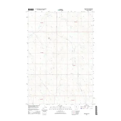
2015 Map of Bams Butte
USGS Topo · Published 2015About this map
Bams Butte dominates this corner of Harding County, rising above a network of drainages that define the high plains of South Dakota. The drainage systems of Double X Cr and Meathook Cr weave through the landscape, their courses carving through the township and range grids of T18N and T17N. This 2015 data illustrates the enduring isolation of the area, where the primary infrastructure consists of isolated cattle-guard routes like Jb Rd and Limpert Rd. The map also traces the path of Wolf Cr as it crosses Park Rd in the southern sections, providing a clear look at the hydrologic patterns and topography that dictate land use in this open ranching country.
Find a feature on this map
13 named features on this map. Tap any name to fly to it.
Don’t see what you’re looking for? This feature index may not catch every label — zoom into the map to look around manually.
Map Details
Editions of this 2015 Bams Butte Map
This is the sole edition of this map. No revisions or reprints were ever made.
Other maps of this area

1935 · Reva
USGS Topo · 1:125,000

1935 · Hoover
USGS Topo · 1:125,000

1954 · Lemmon
USGS Topo · 1:250,000

1957 · Lemmon
USGS Topo · 1:250,000

1968 · Irish Butte
USGS Topo · 1:24,000

1968 · J B Hill
USGS Topo · 1:24,000

1969 · Battleship Rock
USGS Topo · 1:24,000
1971 · Sheep Pen Draw SW
USGS Topo · 1:24,000
1971 · Sheep Pen Draw SE
USGS Topo · 1:24,000
1978 · Bams Butte NW
USGS Topo · 1:24,000