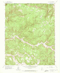
1963 Map of Bancos Mesa
USGS Topo · Published 1972About this map
Carson National Forest land dominates this high-elevation landscape along the border of Archuleta and Rio Arriba counties. The topography is defined by massive formations such as Carracas Mesa and Middle Mesa, separated by a complex network of drainages including Eul Canyon and Cottonwood Canyon. Near the center of the sheet, the small settlement site of Recho de la Doncella sits in a sheltered area below Bancos Mesa.
Find a feature on this map
37 named features on this map. Tap any name to fly to it.
Don’t see what you’re looking for? This feature index may not catch every label — zoom into the map to look around manually.
Map Details
Editions of this 1963 Bancos Mesa Map
Other maps of this area

1889 · Largo
USGS Topo · 1:250,000

1895 · Largo
USGS Topo · 1:250,000

1924 · Pagosa Springs
USGS Topo · 1:125,000

1927 · Pagosa Springs
USGS Topo · 1:125,000

1945 · Durango
USGS Topo · 1:250,000

1953 · Durango
USGS Topo · 1:250,000

1954 · Durango
USGS Topo · 1:250,000

1954 · Allison
USGS Topo · 1:24,000

1954 · Carracas
USGS Topo · 1:24,000

1954 · Rosa
USGS Topo · 1:24,000