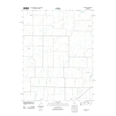
2012 Map of Bancroft
USGS Topo · Published 2012About this map
Bancroft sits at the intersection of rural thoroughfares in northern Missouri, where the landscape is defined by an intricate network of waterways including Tombstone Creek and Long Branch. This 2012 survey documents a countryside transitioned into a patchwork of agricultural plots and managed water resources. Small bodies of water like Billy Herrin Lake and Wayne Moore Lake are scattered across the terrain, alongside engineering features such as the Gates Lake Dam. To the south, Jamesport Lake and Spillman Field highlight the local recreational and community infrastructure. For those interested in local genealogy, the Antioch Cemetery remains a significant landmark near the eastern edge of the quadrangle. The map captures the persistence of traditional creek-fed drainage patterns, with Raccoon Creek and Hickory Creek meandering through the southern sections, while modern road names like Beacon Ave and Granite Ave provide contemporary waypoints for navigating this historic farming region.
Find a feature on this map
30 named features on this map. Tap any name to fly to it.
Don’t see what you’re looking for? This feature index may not catch every label — zoom into the map to look around manually.
Map Details
Editions of this 2012 Bancroft Map
This is the sole edition of this map. No revisions or reprints were ever made.
Other maps of this area

1921 · Chillicothe
USGS Topo · 1:62,500

1922 · Gallatin
USGS Topo · 1:62,500

1923 · Chillicothe
USGS Topo · 1:62,500

1925 · Gilman
USGS Topo · 1:62,500

1946 · Gilman
USGS Topo · 1:48,000

1948 · Gilman
USGS Topo · 1:62,500

1948 · Trenton
USGS Topo · 1:62,500

1953 · Moberly
USGS Topo · 1:250,000

1954 · Centerville
USGS Topo · 1:250,000

1954 · Moberly
USGS Topo · 1:250,000