
2010 Map of Bancroft
USGS Topo · Published 2010About this map
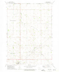
The town of Bancroft serves as the focal point of this North Central Iowa landscape, situated along the upper reaches of the East Fork Des Moines River. The map highlights a highly organized agricultural grid, where the natural flow of Mud Creek has been augmented by early 21st-century water management systems like Drainage Ditch Number 80 and Drainage Ditch No 69. These engineering features reflect the era's reliance on precise drainage to maintain the productivity of the surrounding farmland.
Find a feature on this map
31 named features on this map. Tap any name to fly to it.
Don’t see what you’re looking for? This feature index may not catch every label — zoom into the map to look around manually.
Map Details
Editions of this 2010 Bancroft Map
This is the sole edition of this map. No revisions or reprints were ever made.
Other maps of this area

1954 · Fairmont
USGS Topo · 1:250,000

1958 · Fairmont
USGS Topo · 1:250,000

1972 · German Valley
USGS Topo · 1:24,000

1972 · Bancroft
USGS Topo · 1:24,000

1972 · Titonka
USGS Topo · 1:24,000

1972 · Burt
USGS Topo · 1:24,000

1972 · Ledyard
USGS Topo · 1:24,000
1972 · Lakota
USGS Topo · 1:24,000

1980 · Lone Rock
USGS Topo · 1:24,000

1980 · Swea City
USGS Topo · 1:24,000