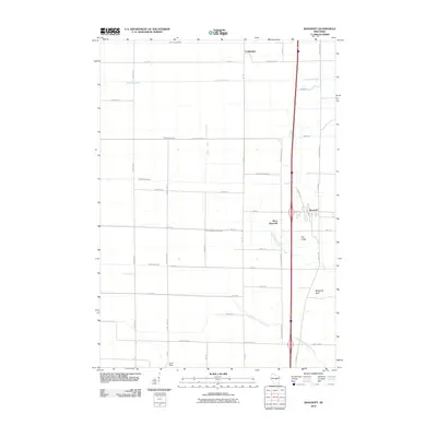
2010 Map of Bancroft
USGS Topo · Published 2010About this map
Bancroft and West Bancroft serve as the primary hubs in this central Wisconsin landscape, where the flat, fertile plains of Portage County are defined by an extensive drainage network. This 2010 survey illustrates the sophisticated agricultural engineering of the region, marked by numerous numbered channels such as Ditch Number Eight, Ditch Number Nine, and Ditch Number Ten. These man-made waterways support the local fields and feed into natural systems like Fourmile Creek and the North Branch Tenmile Creek. To the east, the terrain breaks its regularity with distinctive geological features like The Ledge and Mosquito Bluff, providing a vertical contrast to the surrounding farmland. The settlement pattern remains largely rural, connected by a grid of roads such as Prairie Chicken Rd and Swamp Rd, reflecting the environmental challenges and legacy of the central sands area.
Find a feature on this map
41 named features on this map. Tap any name to fly to it.
Don’t see what you’re looking for? This feature index may not catch every label — zoom into the map to look around manually.
Map Details
Editions of this 2010 Bancroft Map
This is the sole edition of this map. No revisions or reprints were ever made.
Other maps of this area

1955 · Green Bay
USGS Topo · 1:250,000

1957 · Amherst
USGS Topo · 1:48,000

1957 · Whiting
USGS Topo · 1:48,000

1958 · Coloma
USGS Topo · 1:48,000

1959 · Wautoma
USGS Topo · 1:48,000

1968 · Coloma NW
USGS Topo · 1:24,000

1968 · Plainfield
USGS Topo · 1:24,000

1968 · Hancock
USGS Topo · 1:24,000

1969 · Arnott
USGS Topo · 1:24,000
1969 · Almond
USGS Topo · 1:24,000