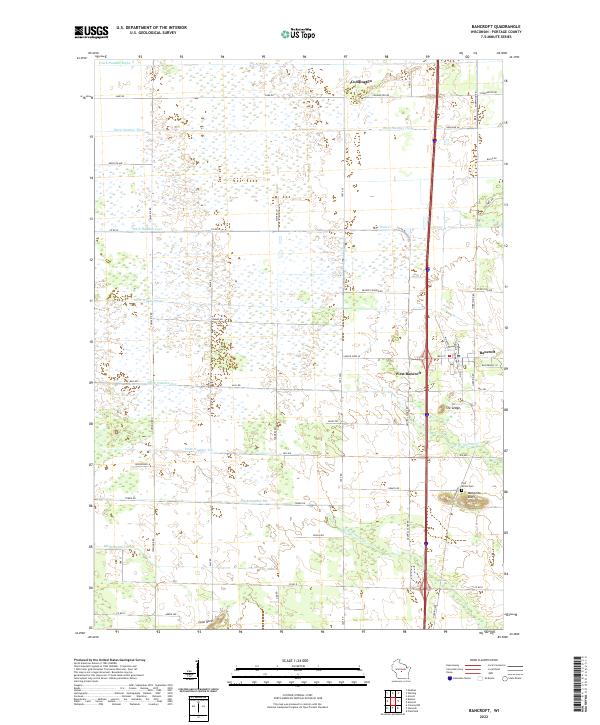
2022 Map of Bancroft
USGS Topo · Published 2022About this map
Bancroft and West Bancroft serve as the primary hubs of this central Wisconsin landscape, situated along a prominent north-south rail and highway corridor. The terrain is defined by an extensive network of drainage infrastructure, featuring numbered waterways such as Ditch Number Three, Ditch Number Five, and Ditch Number Ten that cross the low-lying plains. This engineering effort transformed the wetlands into productive lands, leaving a distinct grid pattern of roads like Townline Rd, Taft Ave, and Meyers Ln.
Find a feature on this map
58 named features on this map. Tap any name to fly to it.
Don’t see what you’re looking for? This feature index may not catch every label — zoom into the map to look around manually.
Map Details
Editions of this 2022 Bancroft Map
This is the sole edition of this map. No revisions or reprints were ever made.
Other maps of this area

1955 · Green Bay
USGS Topo · 1:250,000

1957 · Amherst
USGS Topo · 1:48,000

1957 · Whiting
USGS Topo · 1:48,000

1958 · Coloma
USGS Topo · 1:48,000

1959 · Wautoma
USGS Topo · 1:48,000

1968 · Coloma NW
USGS Topo · 1:24,000

1968 · Plainfield
USGS Topo · 1:24,000

1968 · Hancock
USGS Topo · 1:24,000

1969 · Arnott
USGS Topo · 1:24,000
1969 · Almond
USGS Topo · 1:24,000