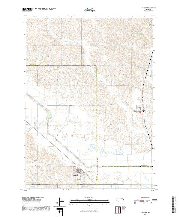
2021 Map of Bancroft
USGS Topo · Published 2021About this map
Bancroft sits at the southern edge of this Cuming County landscape, where the town grid meets the winding course of Little Logan Cr. This 2021 survey illustrates a highly modified agricultural environment, most notably defined by the massive engineering of the Logan Creek Dredge. This straight-line waterway cuts across the traditional meanders of the Old Channel Logan Cr, showing how the natural drainage has been straightened for modern farming. To the northeast, the smaller village of Rosalie is positioned near Big Slough Cr. The map details the intersection of three counties—Cuming, Thurston, and Burt—which converge amidst a dense network of section roads like Road S and 24th Rd, providing a clear view of contemporary Nebraska farm country and its transformed hydraulic history.
Find a feature on this map
41 named features on this map. Tap any name to fly to it.
Don’t see what you’re looking for? This feature index may not catch every label — zoom into the map to look around manually.
Map Details
Editions of this 2021 Bancroft Map
This is the sole edition of this map. No revisions or reprints were ever made.
Other maps of this area

1955 · Sioux City
USGS Topo · 1:250,000

1955 · Fremont
USGS Topo · 1:250,000

1957 · Fremont
USGS Topo · 1:250,000

1958 · Sioux City
USGS Topo · 1:250,000

1958 · Fremont
USGS Topo · 1:250,000

1959 · Sioux City
USGS Topo · 1:250,000

1966 · West Point NW
USGS Topo · 1:24,000

1966 · Lyons
USGS Topo · 1:24,000

1966 · West Point NE
USGS Topo · 1:24,000

1966 · Walthill SW
USGS Topo · 1:24,000