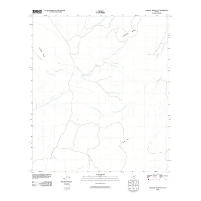
2010 Map of Bandera Mesa South
USGS Topo · Published 2010About this map
Bandera Mesa and Tascotal Mesa dominate this high-desert landscape in Presidio County, where the terrain is defined by a series of significant drainage systems. The Alamo de Cesario Creek and its tributary, the South Fork Alamo de Cesario Creek, carve through the region alongside Terneros Creek and Fresno Creek. This 2010 survey illustrates a sparsely developed ranching or pastoral environment, with very few human-made landmarks beyond the primitive thoroughfare labeled Main Rd. The topography is further interrupted by Panther Canyon, reflecting the intricate water-carved geology of the Trans-Pecos region. Researchers interested in Texas landform history can find clear evidence of how ephemeral water sources have dictated the movement and settlement patterns in this remote western expanse.
Find a feature on this map
8 named features on this map. Tap any name to fly to it.
Don’t see what you’re looking for? This feature index may not catch every label — zoom into the map to look around manually.
Map Details
Editions of this 2010 Bandera Mesa South Map
This is the sole edition of this map. No revisions or reprints were ever made.
Other maps of this area

1903 · Terlingua
USGS Topo · 1:125,000

1904 · Terlingua
USGS Topo · 1:125,000

1917 · Agua Fria
USGS Topo · 1:62,500

1917 · Tascotal Mesa
USGS Topo · 1:62,500

1931 · Lajitas
USGS Topo · 1:62,500

1937 · Agua Fria
USGS Topo · 1:62,500

1944 · Tascotal Mesa
USGS Topo · 1:62,500

1959 · Emory Peak
USGS Topo · 1:250,000

1965 · Emory Peak
USGS Topo · 1:250,000

1971 · Yellow Hill
USGS Topo · 1:24,000