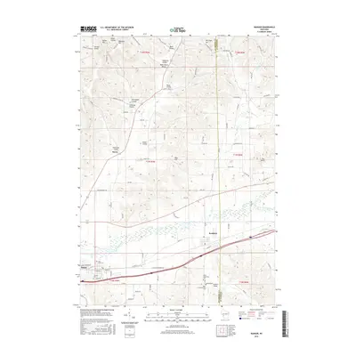
2016 Map of Bangor
USGS Topo · Published 2016About this map
La Crosse River and the Little La Crosse River converge in this corner of the Driftless Area, shaping a landscape of deep valleys and prominent bluffs. The village of Bangor sits as a primary hub along the river, flanked by Fairview Cemetery and Saint Marys Cemetery. To the east, the village of Rockland marks the entry into Monroe County, where the terrain rises sharply into features like The Notch and Moss Hill.
Find a feature on this map
98 named features on this map. Tap any name to fly to it.
Don’t see what you’re looking for? This feature index may not catch every label — zoom into the map to look around manually.
Map Details
Editions of this 2016 Bangor Map
This is the sole edition of this map. No revisions or reprints were ever made.
Other maps of this area

1909 · Sparta
USGS Topo · 1:62,500

1926 · North Bend
USGS Topo · 1:62,500

1927 · La Crosse
USGS Topo · 1:62,500

1928 · Melrose
USGS Topo · 1:48,000

1929 · North Bend
USGS Topo · 1:62,500

1930 · La Crosse
USGS Topo · 1:62,500

1947 · Sparta
USGS Topo · 1:62,500

1949 · Sparta
USGS Topo · 1:62,500

1949 · Melrose
USGS Topo · 1:62,500

1953 · Eau Claire
USGS Topo · 1:250,000