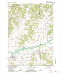
1983 Map of Bangor
USGS Topo · Published 1984About this map
The La Crosse River valley forms the central corridor of this Wisconsin landscape, where the towns of Bangor and Rockland are defined by a dual-railroad network. The Chicago Milwaukee St Paul and Pacific and the Chicago and North Western lines parallel the river, reflecting the heavy industrial and transit reliance on this natural lowland passage. To the north, the terrain transitions into a series of steep coulees, including Norwegian Coulee and Anderson Coulee, which separate prominent rises such as Herman Hill and Heller Hill.
Find a feature on this map
57 named features on this map. Tap any name to fly to it.
Don’t see what you’re looking for? This feature index may not catch every label — zoom into the map to look around manually.
Map Details
Editions of this 1983 Bangor Map
This is the sole edition of this map. No revisions or reprints were ever made.
Other maps of this area

1909 · Sparta
USGS Topo · 1:62,500

1926 · North Bend
USGS Topo · 1:62,500

1927 · La Crosse
USGS Topo · 1:62,500

1928 · Melrose
USGS Topo · 1:48,000

1929 · North Bend
USGS Topo · 1:62,500

1930 · La Crosse
USGS Topo · 1:62,500

1947 · Sparta
USGS Topo · 1:62,500

1949 · Sparta
USGS Topo · 1:62,500

1949 · Melrose
USGS Topo · 1:62,500

1953 · Eau Claire
USGS Topo · 1:250,000