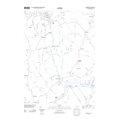
2013 Map of Bangor
USGS Topo · Published 2013About this map
The Bangor town center serves as a dense residential and commercial hub in this northern Pennsylvania corridor, surrounded by numerous historic hamlets and intersections. The landscape is defined by the winding course of Martins Creek and its tributaries, including Waltz Creek and Greenwalk Creek, which pass through smaller settlements like Ackermanville and Flicksville. To the south, the topography transitions toward the banks of the Delaware River, where the riverine communities of Martins Creek, Brainards, and Sandts Eddy are situated.
Find a feature on this map
203 named features on this map. Tap any name to fly to it.
Don’t see what you’re looking for? This feature index may not catch every label — zoom into the map to look around manually.
Map Details
Editions of this 2013 Bangor Map
This is the sole edition of this map. No revisions or reprints were ever made.
Other maps of this area

1890 · Easton
USGS Topo · 1:62,500

1891 · Easton
USGS Topo · 1:62,500

1891 · Delaware Water Gap
USGS Topo · 1:62,500

1893 · Delaware Water Gap
USGS Topo · 1:62,500

1894 · Allentown
USGS Topo · 1:62,500

1914 · Wind Gap
USGS Topo · 1:62,500

1916 · Wind Gap
USGS Topo · 1:62,500

1932 · Easton
USGS Topo · 1:62,500

1936 · Delaware Water Gap
USGS Topo · 1:48,000

1939 · Allentown
USGS Topo · 1:62,500
Featured Places
- Bangor, PA
- Harmony Township, NJ
- Upper Mount Bethel Township, PA
- Ackermanville, Washington Township
- Martins Creek Junction, Washington Township