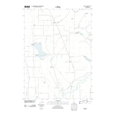
2010 Map of Banida
USGS Topo · Published 2010About this map
Wayland Hot Springs and the winding Bear River anchor the southern landscape of this Idaho quadrangle, where a complex network of irrigation infrastructure supports the region's agricultural life. The map details an extensive system of water management, including the West Cache Canal, Treasureton Canal, and the Twin Lakes Canal West Lateral, which channel water from reservoirs like Twin Lakes Reservoir and Winder Reservoir to the surrounding fields. These engineering works are essential to the small communities and transit points that dot the terrain.
Find a feature on this map
61 named features on this map. Tap any name to fly to it.
Don’t see what you’re looking for? This feature index may not catch every label — zoom into the map to look around manually.
Map Details
Editions of this 2010 Banida Map
This is the sole edition of this map. No revisions or reprints were ever made.
Other maps of this area

1915 · Preston
USGS Topo · 1:96,000

1918 · Preston
USGS Topo · 1:125,000

1954 · Pocatello
USGS Topo · 1:250,000

1955 · Preston
USGS Topo · 1:250,000

1958 · Pocatello
USGS Topo · 1:250,000

1958 · Preston
USGS Topo · 1:250,000

1962 · Preston
USGS Topo · 1:250,000

1968 · Oxford
USGS Topo · 1:24,000

1968 · Clifton
USGS Topo · 1:24,000
1968 · Weston Canyon
USGS Topo · 1:24,000