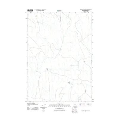
2012 Map of Banjo Flats East
USGS Topo · Published 2012About this map
E Fork Nowater Cr and its associated drainages define this portion of Washakie County, where a network of remote roads and trails supports energy and livestock operations. The landscape is characterized by its distinct drainage systems, including the uniquely named Denver Jake Draw and Little Denver Jake Draw, which cut through the high plains. Industrial and utility access is represented by Mobil Rd and Marconi Rd, highlighting the specialized infrastructure required in this arid Wyoming environment. Further north, Rattlesnake Ridge Rd follows the high ground above Sand Cr and Little Slick Cr, tracing a topography that has likely seen little change in its fundamental character since the early ranching era.
Find a feature on this map
9 named features on this map. Tap any name to fly to it.
Don’t see what you’re looking for? This feature index may not catch every label — zoom into the map to look around manually.
Map Details
Editions of this 2012 Banjo Flats East Map
This is the sole edition of this map. No revisions or reprints were ever made.
Other maps of this area

1955 · Sheridan
USGS Topo · 1:250,000

1955 · Arminto
USGS Topo · 1:250,000

1958 · Sheridan
USGS Topo · 1:250,000

1958 · Arminto
USGS Topo · 1:250,000

1962 · Sheridan
USGS Topo · 1:250,000

1962 · Arminto
USGS Topo · 1:250,000
1966 · Zimmerman Buttes
USGS Topo · 1:24,000
1966 · Banjo Flats West
USGS Topo · 1:24,000

1966 · Cabin Fork
USGS Topo · 1:24,000

1966 · Wagon Prong
USGS Topo · 1:24,000