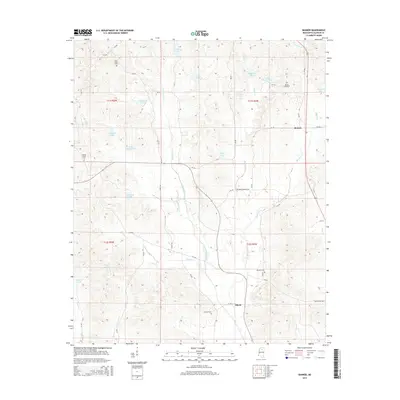
2015 Map of Banner
USGS Topo · Published 2015About this map
Banner and Ellard anchor this portion of Calhoun County, where a network of county roads connects rural homesteads and family cemeteries. The landscape is defined by the headwaters and tributaries of several prominent waterways, including Otoucalofa Cr in the northeast and Persimmon Creek winding through the center. Small impoundments and lakes are scattered throughout the terrain, such as Big Blount Lake, Ivy Lake, and Lovejoy Lake, reflecting the local topography of the region. Genealogists will find significant value in the documentation of several burial grounds, including Union Grove Cem, Concord Cem, and Reasons Cem. The presence of named routes like Sam Nations Rd and Arthur Landreth Rd suggests deep-rooted local history tied to specific families who shaped the development of these rural Mississippi communities.
Find a feature on this map
54 named features on this map. Tap any name to fly to it.
Don’t see what you’re looking for? This feature index may not catch every label — zoom into the map to look around manually.
Map Details
Editions of this 2015 Banner Map
This is the sole edition of this map. No revisions or reprints were ever made.
Other maps of this area

1953 · West Point
USGS Topo · 1:250,000

1954 · Pittsboro
USGS Topo · 1:62,500

1954 · Water Valley
USGS Topo · 1:62,500

1955 · Water Valley
USGS Topo · 1:62,500

1955 · Coffeeville
USGS Topo · 1:62,500

1956 · Tupelo
USGS Topo · 1:250,000

1958 · Tupelo
USGS Topo · 1:250,000

1958 · West Point
USGS Topo · 1:250,000

1963 · West Point
USGS Topo · 1:250,000

1972 · Paris
USGS Topo · 1:24,000