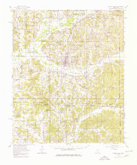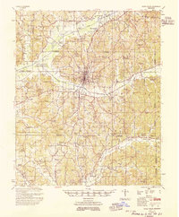
1955 Map of Water Valley
USGS Topo · Published 1955About this map
The Illinois Central railroad corridor anchors the community of Water Valley, a vital hub in North Mississippi at the intersection of several county lines. This 1955 survey captures the regional landscape during a period of significant hydrological change, dominated by the Enid Reservoir along the Yocona River. The map meticulously records the extensive network of rural churches and cemeteries that defined social life in the 1950s, such as Kind Providence Ch & Cem and South Hopewell Ch.
Find a feature on this map
100 named features on this map. Tap any name to fly to it.
Don’t see what you’re looking for? This feature index may not catch every label — zoom into the map to look around manually.
Map Details
Editions of this 1955 Water Valley Map
This is the sole edition of this map. No revisions or reprints were ever made.