1952 Map of Sardis
USGS Topo · Published 1965About this map
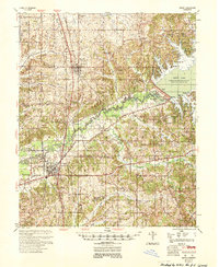
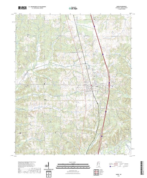
The Tallahatchie River and its fork dominate this northern Mississippi landscape, recently transformed by the engineering of the Sardis Dam. At the time of this mid-century survey, the massive Sardis Lake had established a new shoreline, creating recreation areas like Sardis Lake State Park and Lower Lake Beach while submerged lands were repurposed for conservation. Along the southern bank, the Illinois Central Railroad serves the regional hubs of Sardis and Batesville, providing a vital transit corridor for the agricultural valley. The map is exceptionally dense with community landmarks that provide significant genealogical value, including a high concentration of combined church and school sites such as Walton Chapel Sch & Cem and Rock Hill Ch Sch & Cem. These clusters, alongside family-named landmarks like Moccasin Point and Thompson Creek Ldg, reveal the deeply rooted rural social structure of Panola County during the early 1950s.
Find a feature on this map
102 named features on this map. Tap any name to fly to it.
Don’t see what you’re looking for? This feature index may not catch every label — zoom into the map to look around manually.
Map Details
Editions of this 1952 Sardis Map
This is the sole edition of this map. No revisions or reprints were ever made.
Historical Maps of Batesville Through Time
8 maps found