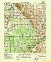
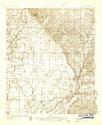
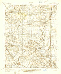
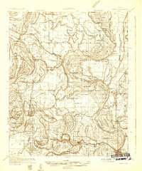
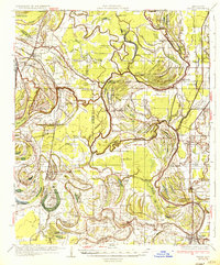
1939 Map of Sledge
USGS Topo · Published 1943About this map
The Yazoo and Mississippi Valley RR anchors the Delta landscape on this 1939 survey, tracing a path through a territory defined by intricate waterways and rural outposts. The map reveals the vital importance of the Tallahatchie River and its myriad branches like Pecan Bayou and David Bayou, which dictated the location of early crossings such as Squirrel Bridge and Porters Ferry. The presence of the Old Chickasaw Boundary cutting across the terrain serves as a reminder of earlier territorial divisions that shaped the local survey lines.
Find a feature on this map
72 named features on this map. Tap any name to fly to it.
Don’t see what you’re looking for? This feature index may not catch every label — zoom into the map to look around manually.
Map Details
Editions of this 1939 Sledge Map
This is the sole edition of this map. No revisions or reprints were ever made.
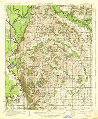
Other maps of this area

1908 · Walnut Lake
USGS Topo · 1:24,000

1910 · Walnut Lake
USGS Topo · 1:31,680
1932 · Sledge
USGS Topo · 1:48,000
1932 · Tutwiler
USGS Topo · 1:48,000
1932 · Marks
USGS Topo · 1:48,000

1932 · Crenshaw
USGS Topo · 1:62,500

1935 · Crowder
USGS Topo · 1:62,500
1935 · Marks
USGS Topo · 1:62,500
1935 · Crenshaw
USGS Topo · 1:62,500
1935 · Tutwiler
USGS Topo · 1:62,500