
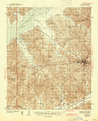
1943 Map of Oxford
USGS Topo · Published 1943About this map
University of Mississippi serves as the cultural and geographical anchor for Lafayette County in this early 1940s landscape, which is defined by the significant hydrological impact of the Sardis Reservoir Tallahatchie River in the northwest. The expansion of the reservoir during this era altered local drainage and land use, seen here along Toby Tubby Creek and Hurricane Creek. Away from the water, the terrain is dotted with an extensive network of small rural institutions that supported the local agricultural economy, including the Spring Hill Sch & Ch and the Harrisonville Sch.
Find a feature on this map
65 named features on this map. Tap any name to fly to it.
Don’t see what you’re looking for? This feature index may not catch every label — zoom into the map to look around manually.
Map Details
Editions of this 1943 Oxford Map
2 editions found
Other maps of this area

1940 · Oxford
USGS Topo · 1:62,500

1942 · Denmark
USGS Topo · 1:62,500

1943 · Denmark
USGS Topo · 1:62,500

1944 · Senatobia
USGS Topo · 1:62,500

1944 · Tyro
USGS Topo · 1:62,500

1944 · Potts Camp
USGS Topo · 1:62,500

1945 · Potts Camp
USGS Topo · 1:62,500

1952 · Sardis
USGS Topo · 1:62,500

1953 · Sardis
USGS Topo · 1:62,500

1954 · Oakland
USGS Topo · 1:62,500