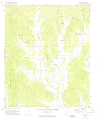
1972 Map of Banner
USGS Topo · Published 1974About this map
The settlement of Banner sits at the center of this 1970s landscape, characterized by a complex network of small private lakes and narrow creek bottoms in rural Calhoun County. Numerous family-named water bodies like Williams Lake, Costner Lake, and Edwards Lake dot the terrain, reflecting a local economy tied to water management and land ownership. The presence of the Banner Compressor Station and a prominent Radio Tower indicate the infrastructure of the era, while the Banner Lookout Tower overlooks the surrounding ridges and valleys.
Find a feature on this map
37 named features on this map. Tap any name to fly to it.
Don’t see what you’re looking for? This feature index may not catch every label — zoom into the map to look around manually.
Map Details
Editions of this 1972 Banner Map
This is the sole edition of this map. No revisions or reprints were ever made.
Other maps of this area

1953 · West Point
USGS Topo · 1:250,000
1954 · Pittsboro
USGS Topo · 1:62,500
1954 · Water Valley
USGS Topo · 1:62,500
1955 · Water Valley
USGS Topo · 1:62,500
1955 · Coffeeville
USGS Topo · 1:62,500

1956 · Tupelo
USGS Topo · 1:250,000

1958 · Tupelo
USGS Topo · 1:250,000

1958 · West Point
USGS Topo · 1:250,000

1963 · West Point
USGS Topo · 1:250,000
1972 · Paris
USGS Topo · 1:24,000