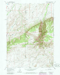
1960 Map of Banner Mtn
USGS Topo · Published 1985About this map
Medicine Bow National Forest dominates the high-elevation landscape of this 1960s survey, updated in the mid-1980s. The terrain is defined by the massive Banner Mountain and the deep incision of Lower Deer Creek Canyon. A sparse network of ranching outposts and camps indicates a working mountain economy, with named family sites like Banner Ranch, Keith Ranch, and Rissler Ranch scattered across the draws and canyons.
Find a feature on this map
37 named features on this map. Tap any name to fly to it.
Don’t see what you’re looking for? This feature index may not catch every label — zoom into the map to look around manually.
Map Details
Editions of this 1960 Banner Mtn Map
2 editions found

Other maps of this area

1949 · Brookhurst
USGS Topo · 1:24,000

1949 · Parkerton
USGS Topo · 1:24,000

1950 · Lockett
USGS Topo · 1:24,000

1950 · Brookhurst
USGS Topo · 1:24,000

1950 · Parkerton
USGS Topo · 1:24,000

1954 · Torrington
USGS Topo · 1:250,000

1955 · Casper
USGS Topo · 1:250,000

1958 · Casper
USGS Topo · 1:250,000

1958 · Torrington
USGS Topo · 1:250,000

1960 · Ice Cave Mountain
USGS Topo · 1:24,000