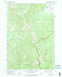
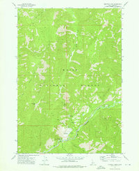
1972 Map of Banner Summit
USGS Topo · Published 1975About this map
The high Sawtooth Range landscape of central Idaho is defined here by the crossing of the Custer and Boise county lines at the prominent Banner Summit. This high-altitude terrain serves as a drainage divide where headwaters like the North Fork Boise River and Marsh Creek begin their descent. The presence of several high-mountain basins, including Bull Trout Lake, Newman Lake, and Dutch Lake, highlights the alpine character of the region during the early 1970s. Historical land use is evident in the cluster of Mines located on the slopes of Copper Mountain, suggesting a legacy of resource extraction alongside the recreational infrastructure of the Challis and Boise National Forests. An extensive network of primitive routes, such as the Thatcher Trail and various Jeep Trails, provides insight into the movement of foresters and early backcountry travelers through this wilderness area.
Find a feature on this map
38 named features on this map. Tap any name to fly to it.
Don’t see what you’re looking for? This feature index may not catch every label — zoom into the map to look around manually.
Map Details
Editions of this 1972 Banner Summit Map
This is the sole edition of this map. No revisions or reprints were ever made.
Other maps of this area

1891 · Bear Valley
USGS Topo · 1:125,000

1893 · Bear Valley
USGS Topo · 1:125,000

1957 · Challis
USGS Topo · 1:250,000

1960 · Challis
USGS Topo · 1:250,000

1963 · Challis
USGS Topo · 1:250,000
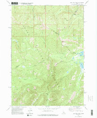
1972 · Bull Trout Point
USGS Topo · 1:24,000
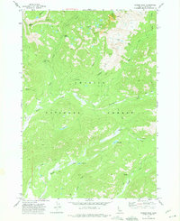
1972 · Langer Peak
USGS Topo · 1:24,000
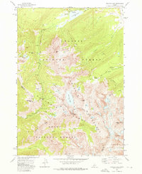
1972 · Stanley Lake
USGS Topo · 1:24,000
1972 · Eightmile Mtn
USGS Topo · 1:24,000
1972 · Grandjean
USGS Topo · 1:24,000