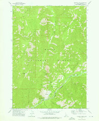
1972 Map of Eightmile Mtn
USGS Topo · Published 1976About this map
Bonnerille Hot Springs and the surrounding wilderness of the Boise National Forest dominate this 1970s topographic study. The landscape is defined by the steep drainage basins of the South Fork Payette River, where remote infrastructure such as the Warm Springs Forest Service Station and the Warm Springs Landing Strip supported backcountry management and recreation.
Find a feature on this map
26 named features on this map. Tap any name to fly to it.
Don’t see what you’re looking for? This feature index may not catch every label — zoom into the map to look around manually.
Map Details
Editions of this 1972 Eightmile Mtn Map
This is the sole edition of this map. No revisions or reprints were ever made.
Other maps of this area

1891 · Bear Valley
USGS Topo · 1:125,000

1893 · Bear Valley
USGS Topo · 1:125,000

1957 · Challis
USGS Topo · 1:250,000

1960 · Challis
USGS Topo · 1:250,000

1963 · Challis
USGS Topo · 1:250,000

1972 · Bull Trout Point
USGS Topo · 1:24,000
1972 · Banner Summit
USGS Topo · 1:24,000

1972 · Cache Creek
USGS Topo · 1:24,000
1972 · Tyee Mountain
USGS Topo · 1:24,000
1972 · Miller Mtn East
USGS Topo · 1:24,000