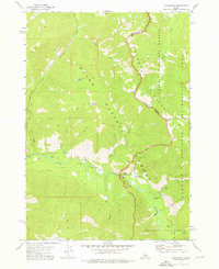
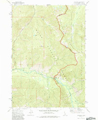
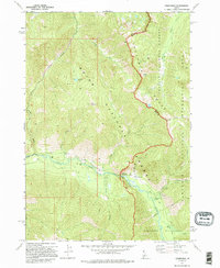
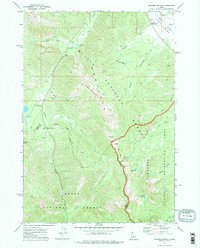
1972 Map of Grandjean
USGS Topo · Published 1976About this map
The Grandjean settlement sits at the confluence of several mountain drainages in the early 1970s, serving as a gateway to the high peaks of the Sawtooth Range. The landscape is dominated by the intersection of the Boise National Forest and Challis National Forest, with the South Fork Payette River carving through the center of the sheet. High-altitude features like Mt Zumwalt and Zumwalt Lake stand north of the river, while the eastern portion of the map transitions into the Sawtooth National Recreation Area.
Find a feature on this map
23 named features on this map. Tap any name to fly to it.
Don’t see what you’re looking for? This feature index may not catch every label — zoom into the map to look around manually.
Map Details
Editions of this 1972 Grandjean Map
3 editions found
Other maps of this area

1891 · Bear Valley
USGS Topo · 1:125,000

1893 · Bear Valley
USGS Topo · 1:125,000

1957 · Challis
USGS Topo · 1:250,000

1960 · Challis
USGS Topo · 1:250,000

1963 · Challis
USGS Topo · 1:250,000
1972 · Bull Trout Point
USGS Topo · 1:24,000
1972 · Banner Summit
USGS Topo · 1:24,000
1972 · Tyee Mountain
USGS Topo · 1:24,000
1972 · Stanley Lake
USGS Topo · 1:24,000
1972 · Eightmile Mtn
USGS Topo · 1:24,000