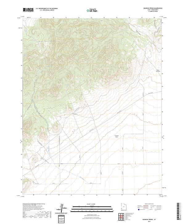
2023 Map of Bannion Spring
USGS Topo · Published 2023About this map
The Indian Peak Range dominates the northern half of this Iron County landscape, where the terrain transitions from steep ridges into the wide, flat expanse of the Escalante Desert. This high-desert environment is characterized by a network of essential water sources including Bannion Spring, Rosebud Spring, and Serviceberry Spring, which would have been critical markers for travelers and ranchers in this remote corner of Utah. The infrastructure of the area is largely defined by the Tillie Spring Pipe Line and several primitive roads like Eight Mile Rd. Notable landforms such as Wilson Canyon and Marys Hollow segment the foothills, while drainage features like Negro Liza Wash and Tillie Creek illustrate the natural flow of seasonal water toward the basin. The map provides a clear record of the relationship between the rugged upland topography and the desert floor below.
Find a feature on this map
19 named features on this map. Tap any name to fly to it.
Don’t see what you’re looking for? This feature index may not catch every label — zoom into the map to look around manually.
Map Details
Editions of this 2023 Bannion Spring Map
This is the sole edition of this map. No revisions or reprints were ever made.
Other maps of this area

1885 · St. George
USGS Topo · 1:250,000

1891 · St. George
USGS Topo · 1:250,000

1953 · Richfield
USGS Topo · 1:250,000

1953 · Cedar City
USGS Topo · 1:250,000

1958 · Richfield
USGS Topo · 1:250,000

1958 · Cedar City
USGS Topo · 1:250,000

1962 · Cedar City
USGS Topo · 1:250,000

1971 · Steamboat Mtn SW
USGS Topo · 1:24,000

1971 · Bible Spring
USGS Topo · 1:24,000

1971 · Steamboat Mtn
USGS Topo · 1:24,000