
1971 Map of Bible Spring
USGS Topo · Published 1974About this map
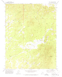
The Indian Peak Range and North Peaks dominate this high-altitude landscape in southwestern Utah, where the terrain is defined by a series of springs and seasonal washes. Names like Typhoid Spring and Bible Spring hint at the human history of this arid environment, where water sources were critical markers for travelers and livestock. The map traces a complex network of transportation, including the Sawmill Trail through Sawmill Canyon and various unnamed jeep trails and pack trails that navigate the ridges. These routes suggest a history of resource extraction and ranching, reinforced by the presence of mineral prospects and cattle-related infrastructure such as a Water Tank and Borrow Pit. Distinctive geological features like the White Cliff and the oddly named The Movies provide landmarks for those navigating the backcountry of Iron County.
Find a feature on this map
28 named features on this map. Tap any name to fly to it.
Don’t see what you’re looking for? This feature index may not catch every label — zoom into the map to look around manually.
Map Details
Editions of this 1971 Bible Spring Map
This is the sole edition of this map. No revisions or reprints were ever made.
Other maps of this area

1885 · St. George
USGS Topo · 1:250,000

1891 · St. George
USGS Topo · 1:250,000

1953 · Richfield
USGS Topo · 1:250,000

1953 · Cedar City
USGS Topo · 1:250,000

1958 · Richfield
USGS Topo · 1:250,000

1958 · Cedar City
USGS Topo · 1:250,000

1962 · Cedar City
USGS Topo · 1:250,000

1971 · Observation Knoll
USGS Topo · 1:24,000

1971 · Pinto Spring
USGS Topo · 1:24,000
1971 · The Tetons
USGS Topo · 1:24,000