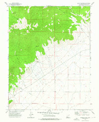
1972 Map of Bannion Spring
USGS Topo · Published 1976About this map
Bannion Spring and the surrounding high country of Iron County define this 1970s topographic study. The landscape is characterized by a stark division between steep, wooded slopes and the more level plains to the southeast. Water sources are the primary points of interest in this arid environment, with several named features like Rosebud Spring, Upper Trough Spring, and Lower Trough Spring providing critical infrastructure for cattle and wildlife. Drainage patterns are clearly marked through Pillie Creek and the long course of Marys Hollow. Human activity is primarily evidenced by a network of unimproved roads and a Jeep Trail that cuts through the northern canyons. These routes navigate the complex terrain of Negro Wilson Canyon and Liza Draw, showing how the local geography dictated movement through the high desert during this era.
Find a feature on this map
17 named features on this map. Tap any name to fly to it.
Don’t see what you’re looking for? This feature index may not catch every label — zoom into the map to look around manually.
Map Details
Editions of this 1972 Bannion Spring Map
This is the sole edition of this map. No revisions or reprints were ever made.
Other maps of this area

1885 · St. George
USGS Topo · 1:250,000

1891 · St. George
USGS Topo · 1:250,000

1953 · Richfield
USGS Topo · 1:250,000

1953 · Cedar City
USGS Topo · 1:250,000

1958 · Richfield
USGS Topo · 1:250,000

1958 · Cedar City
USGS Topo · 1:250,000

1962 · Cedar City
USGS Topo · 1:250,000

1971 · Steamboat Mtn SW
USGS Topo · 1:24,000

1971 · Bible Spring
USGS Topo · 1:24,000

1971 · Steamboat Mtn
USGS Topo · 1:24,000