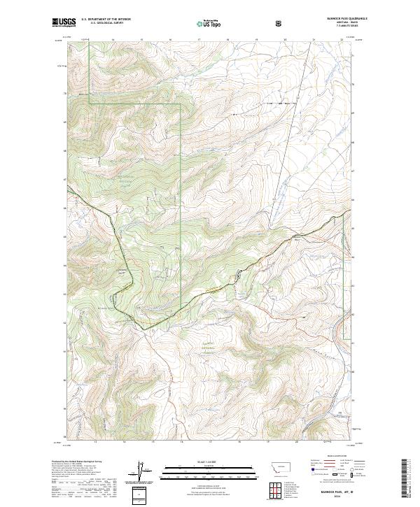
2024 Map of Bannock Pass
USGS Topo · Published 2024About this map
Bannock Pass serves as a critical geographic marker along the Idaho-Montana border, where the Continental Divide winds through the high peaks of the Beaverhead Mountains. This recent survey documents a landscape defined by significant national heritage corridors, including the Continental Divide National Scenic Trail and the Nez Perce (Nee-Me-Poo) National Historic Trail. The terrain transitions between the Beaverhead National Forest and Salmon National Forest, revealing a network of remote springs such as Wagonbox Spring and Boche Spring. Transportation history is visible in the naming of Railroad Canyon and various access routes like S Divide Creek Rd, while the hydrology is dominated by the headwaters of North Fork Divide Creek and Canyon Creek.
Find a feature on this map
52 named features on this map. Tap any name to fly to it.
Don’t see what you’re looking for? This feature index may not catch every label — zoom into the map to look around manually.
Map Details
Editions of this 2024 Bannock Pass Map
This is the sole edition of this map. No revisions or reprints were ever made.
Other maps of this area

1955 · Dubois
USGS Topo · 1:250,000

1956 · Leadore
USGS Topo · 1:62,500

1956 · Morrison Lake
USGS Topo · 1:62,500

1958 · Dubois
USGS Topo · 1:250,000

1965 · Deadman Pass
USGS Topo · 1:24,000

1965 · Jeff Davis Peak
USGS Topo · 1:24,000

1965 · Lemhi Pass
USGS Topo · 1:24,000
1965 · Everson Creek
USGS Topo · 1:24,000

1965 · Bannock Pass
USGS Topo · 1:24,000
1965 · Goat Mountain
USGS Topo · 1:24,000