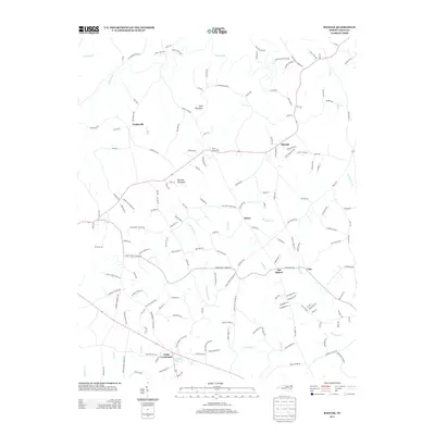
2013 Map of Banoak
USGS Topo · Published 2013About this map
Banoak and the surrounding rural communities of Lincoln and Cleveland Counties are defined by a dense network of family roads and winding creek valleys. Cooksville and Wrays Crossroads anchor the northern reaches of the map, while Cat Square and Vale serve as local hubs further south. The landscape is notably hilly, rising to peaks at Lynn Mountain and Brendle Mountain, which overlook the twisting path of Jacob Fork. Along the southern border, Hulls Crossroads sits near Taylors Lake, marking a junction of regional importance. The map reflects a deeply established agricultural and residential pattern, where the terrain is segmented by numerous named tributaries like Little Indian Cr and Howards Cr, suggesting a long history of localized settlement and land division among the area's residents.
Find a feature on this map
160 named features on this map. Tap any name to fly to it.
Don’t see what you’re looking for? This feature index may not catch every label — zoom into the map to look around manually.
Map Details
Editions of this 2013 Banoak Map
This is the sole edition of this map. No revisions or reprints were ever made.
Other maps of this area

1895 · Hickory
USGS Topo · 1:125,000

1905 · Morganton
USGS Topo · 1:125,000

1909 · Lincolnton
USGS Topo · 1:62,500

1911 · Lincolnton
USGS Topo · 1:62,500

1950 · Shelby
USGS Topo · 1:62,500

1953 · Charlotte
USGS Topo · 1:250,000

1954 · Charlotte
USGS Topo · 1:250,000

1956 · Valdese
USGS Topo · 1:24,000

1956 · Casar
USGS Topo · 1:24,000

1960 · Charlotte
USGS Topo · 1:250,000