
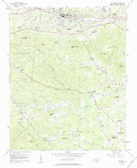
1956 Map of Valdese
USGS Topo · Published 1958About this map
Valdese and Drexel anchor the northern landscape of this mid-1950s Burke County survey, where the Southern railroad corridor established a string of industrial and educational centers. The topography transitions from the developed corridor of Rutherford College and Connellys Springs into the more complex terrain of the South Mountains to the south. This area is characterized by a high density of rural religious centers, including Bollingers Chapel, Abees Grove Ch, and Warlicks Chapel, many of which were central to the small farming communities along the Henry Fork and Lower Fork waterways.
Find a feature on this map
58 named features on this map. Tap any name to fly to it.
Don’t see what you’re looking for? This feature index may not catch every label — zoom into the map to look around manually.
Map Details
Editions of this 1956 Valdese Map
2 editions found
Other maps of this area

1895 · Hickory
USGS Topo · 1:125,000

1905 · Morganton
USGS Topo · 1:125,000

1953 · Charlotte
USGS Topo · 1:250,000

1954 · Charlotte
USGS Topo · 1:250,000

1956 · Benn Knob
USGS Topo · 1:24,000

1956 · Morganton North
USGS Topo · 1:24,000

1956 · Casar
USGS Topo · 1:24,000

1956 · Morganton South
USGS Topo · 1:24,000

1956 · Drexel
USGS Topo · 1:24,000

1956 · Lenoir
USGS Topo · 1:62,500