
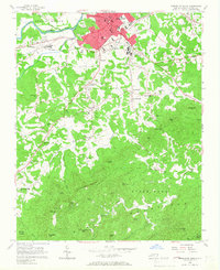
1956 Map of Morganton South
USGS Topo · Published 1958About this map
The Morganton town center and its institutional anchors define the northern landscape of this mid-century survey. Major facilities such as the State Hospital and the State Sch for the Deaf occupy prominent grounds, while the Southern railroad line runs through the heart of the settlement. North of the Catawba River, the flat terrain of Quaker Meadow contrasts sharply with the southern half of the map, which ascends into the dense, knob-filled terrain of the South Mountains.
Find a feature on this map
68 named features on this map. Tap any name to fly to it.
Don’t see what you’re looking for? This feature index may not catch every label — zoom into the map to look around manually.
Map Details
Editions of this 1956 Morganton South Map
2 editions found
Other maps of this area

1905 · Morganton
USGS Topo · 1:125,000

1953 · Charlotte
USGS Topo · 1:250,000

1954 · Charlotte
USGS Topo · 1:250,000

1956 · Valdese
USGS Topo · 1:24,000

1956 · Oak Hill
USGS Topo · 1:24,000

1956 · Benn Knob
USGS Topo · 1:24,000

1956 · Morganton North
USGS Topo · 1:24,000

1956 · Casar
USGS Topo · 1:24,000

1956 · Drexel
USGS Topo · 1:24,000

1956 · Linville Falls
USGS Topo · 1:62,500