
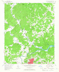
1956 Map of Morganton North
USGS Topo · Published 1958About this map
The Catawba River and Johns River converge near the northern edge of Morganton, providing a geographical focus for this mid-century survey of Burke Co and Caldwell Co. The map records a landscape transitioning from the river valleys of Quaker Meadow to the higher elevations of Upper Creek. Along the many winding tributaries, such as Warrior Fork and Lower Creek, small community centers like Arneys Store, Worry, and Hartland appear alongside numerous rural institutions. The religious and educational infrastructure of the period is well-documented, from the Corpening Sch to several mission churches like St Marys Mission Ch and Mission Ch. In the southeast, the Southern railroad line follows the riverbank, passing by the newly formed Rhodhiss Lake and the industrial Filtration Plant.
Find a feature on this map
49 named features on this map. Tap any name to fly to it.
Don’t see what you’re looking for? This feature index may not catch every label — zoom into the map to look around manually.
Map Details
Editions of this 1956 Morganton North Map
2 editions found
Other maps of this area

1905 · Morganton
USGS Topo · 1:125,000

1953 · Charlotte
USGS Topo · 1:250,000

1954 · Charlotte
USGS Topo · 1:250,000

1956 · Valdese
USGS Topo · 1:24,000

1956 · Oak Hill
USGS Topo · 1:24,000

1956 · Collettsville
USGS Topo · 1:24,000

1956 · Morganton South
USGS Topo · 1:24,000

1956 · Lenoir
USGS Topo · 1:24,000
1956 · Chestnut Mtn.
USGS Topo · 1:24,000

1956 · Drexel
USGS Topo · 1:24,000