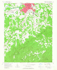
1956 Map of Morganton South
USGS Topo · Published 1966About this map
Morganton serves as the focal point of this mid-century survey, sprawling south from the Catawba River toward the foothills of the South Mountains. The urban center is defined by institutional landmarks including the State Sch for the Deaf and the extensive State Hospital complex. Transportation patterns are anchored by the Southern railroad line, which skirts the river and the settlement of Calvin.
Find a feature on this map
66 named features on this map. Tap any name to fly to it.
Don’t see what you’re looking for? This feature index may not catch every label — zoom into the map to look around manually.
Map Details
Editions of this 1956 Morganton South Map
2 editions found
Other maps of this area

1905 · Morganton
USGS Topo · 1:125,000

1953 · Charlotte
USGS Topo · 1:250,000

1954 · Charlotte
USGS Topo · 1:250,000

1956 · Valdese
USGS Topo · 1:24,000

1956 · Oak Hill
USGS Topo · 1:24,000

1956 · Benn Knob
USGS Topo · 1:24,000

1956 · Morganton North
USGS Topo · 1:24,000

1956 · Casar
USGS Topo · 1:24,000

1956 · Morganton South
USGS Topo · 1:24,000

1956 · Drexel
USGS Topo · 1:24,000