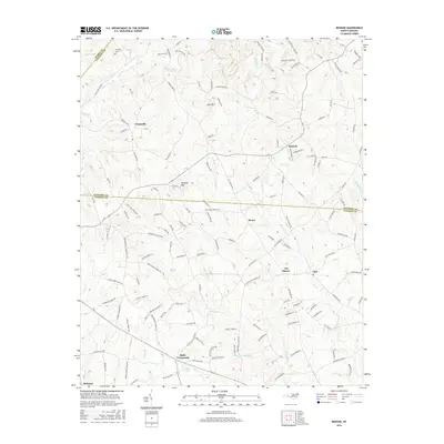
2016 Map of Banoak
USGS Topo · Published 2016About this map
Hulls Crossroads and Cat Square anchor this rural landscape where the boundaries of Burke, Catawba, and Lincoln Counties converge. The terrain is defined by prominent rises like Lynn Mtn and Brendle Mtn, with a dense network of creeks including Jacob Fork, Indian Cr, and Howards Cr draining the Piedmont countryside. This survey captures a pattern of dispersed agricultural settlements connected by family-named roads such as Maw Huffman Rd and Jake Seagle Rd, reflecting the deep-rooted genealogical history of the region. Local community life is centered around numerous country churches, including Davids Chapel Church and Sardis Church, along with the Northbrook III School. Near the northern edge, the Chapman Cemetery sits overlooking the banks of the Douglas Creek, providing a specific point of interest for researchers tracing early local families.
Find a feature on this map
153 named features on this map. Tap any name to fly to it.
Don’t see what you’re looking for? This feature index may not catch every label — zoom into the map to look around manually.
Map Details
Editions of this 2016 Banoak Map
This is the sole edition of this map. No revisions or reprints were ever made.
Other maps of this area

1895 · Hickory
USGS Topo · 1:125,000

1905 · Morganton
USGS Topo · 1:125,000

1909 · Lincolnton
USGS Topo · 1:62,500

1911 · Lincolnton
USGS Topo · 1:62,500

1950 · Shelby
USGS Topo · 1:62,500

1953 · Charlotte
USGS Topo · 1:250,000

1954 · Charlotte
USGS Topo · 1:250,000

1956 · Valdese
USGS Topo · 1:24,000

1956 · Casar
USGS Topo · 1:24,000

1960 · Charlotte
USGS Topo · 1:250,000