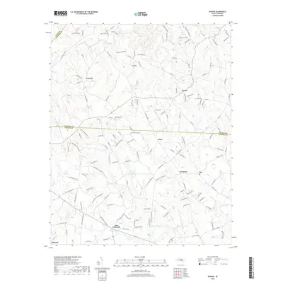
2019 Map of Banoak
USGS Topo · Published 2019About this map
Hulls Crossroads and Cat Square anchor this Piedmont landscape where the boundaries of Burke, Catawba, and Lincoln Counties converge. The area is defined by a dense network of family-named roads and rural communities like Banoak and Henry, illustrating a long-standing pattern of dispersed agricultural settlement. Waterways including Jacob Fork and Indian Cr drain the undulating terrain, while prominent heights like Lynn Mtn and Brendle Mtn rise above the surrounding fields. Local history is etched into the map through features like Chapman Cem and Steiger Field, marking generations of land use. In the southern reaches, the settlement of Belwood sits near the headwaters of Buffalo Cr, while Taylors Lake provides a localized water source. The map reflects a modern era where traditional crossroads remain central to the geography of these North Carolina foothills.
Find a feature on this map
147 named features on this map. Tap any name to fly to it.
Don’t see what you’re looking for? This feature index may not catch every label — zoom into the map to look around manually.
Map Details
Editions of this 2019 Banoak Map
This is the sole edition of this map. No revisions or reprints were ever made.
Other maps of this area

1895 · Hickory
USGS Topo · 1:125,000

1905 · Morganton
USGS Topo · 1:125,000

1909 · Lincolnton
USGS Topo · 1:62,500

1911 · Lincolnton
USGS Topo · 1:62,500

1950 · Shelby
USGS Topo · 1:62,500

1953 · Charlotte
USGS Topo · 1:250,000

1954 · Charlotte
USGS Topo · 1:250,000

1956 · Valdese
USGS Topo · 1:24,000

1956 · Casar
USGS Topo · 1:24,000

1960 · Charlotte
USGS Topo · 1:250,000